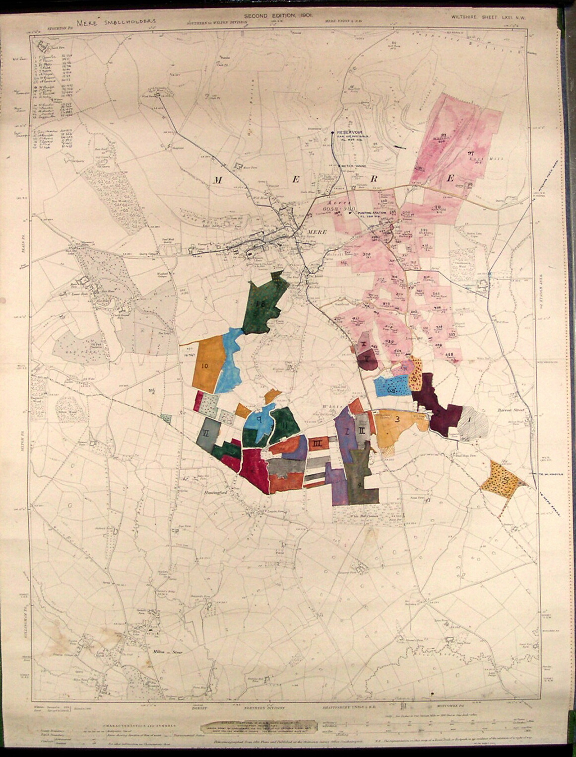
Brief description: 1 to 10560 Ordnance Survey map marked to show smallholders and water supply in Mere, Wiltshire early-mid 20 cen.
Place: Mere
County: Wiltshire
width: 45cm
height: 59cm
Classifications:
environment | maps | society | water | agriculture
Material: paper; textile
Condition: good